The village is nestled between a variety of masts, and therefore checking out what type of coverage you can expect from the different providers is useful.
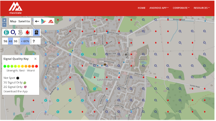
Mastdata.com is a UK mobile telecoms base station resource tool used by contractors and operators across the mobile telecommunications sector. The site is designed to help people understand what currently exists and for the industry to plan new projects.
Follow the drop down ‘Resources’ menu to look at Coverage Maps or ‘Coverage by Town’. You can find Lytchet Matravers by clicking on a nearby town and then navigating to the bottom of the page the Postcode Search is displayed or via the following link https://mastdata.com/resources/coverage-map.aspx?mnc=0&gen=4&lat=50.757808221110366&lng=-2.0766838706795467&z=16
Depending on the options you select, it shows the expected coverage from each network and the best network for a particular spot.